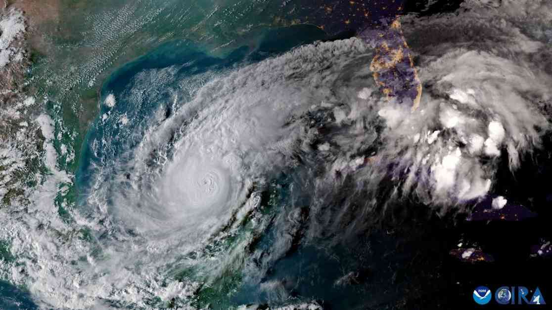
Hurricane Milton is rapidly intensifying into a Category 5 storm as it heads towards Florida. The International Space Station captured stunning footage of the storm, showing its powerful winds and pinhole eye. Meteorologists are amazed by the storm’s intensity, with some calling it “astronomical.”
The storm transformed from a Category 1 to a Category 5 in just a few hours, surprising forecasters and defying hurricane models. It is now a Category 4 storm and is expected to make landfall in Tampa Bay on Wednesday night or Thursday morning.
Satellite images from NOAA’s GOES satellite show the storm spinning above the Yucatan Peninsula. Cold temperatures in the center of the storm indicate intense thunderstorms and deep convection. Another video from Colorado State University’s CIRA shows lightning flashing across the storm’s eye wall.
The approaching hurricane has led to evacuation orders in Florida, with officials warning of the storm’s potentially devastating impact. Mayor Ken Welch of St. Petersburg described Milton as the most impactful storm the region has faced, surpassing the recent Hurricane Helene.
The storm’s rapid intensification is linked to record-high sea surface temperatures worldwide, which fuel more active hurricane seasons. As the effects of climate change continue to be felt, storms like Milton may become more common and more dangerous.
As we brace for the impact of Hurricane Milton, it serves as a stark reminder of the growing threat of extreme weather events in our changing climate. Stay informed, stay safe, and be prepared for the challenges that lie ahead.


