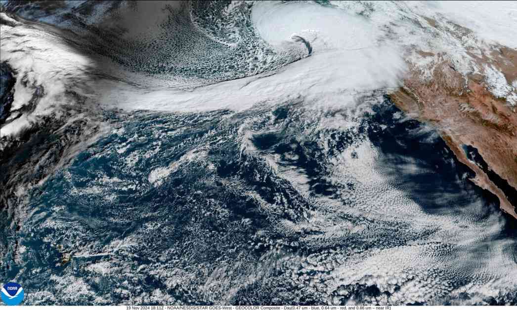
A major storm is brewing on the West Coast, bringing with it a “bomb cyclone” and an atmospheric river that will unleash heavy rain, snow, and damaging winds from California to British Columbia. The term “bomb cyclone” refers to a rapid drop in atmospheric pressure, leading to strong winds and intense precipitation.
The storm is expected to hit parts of the U.S. Northwest and northern California, with wind speeds reaching up to 70 miles per hour. This could result in power outages and tree damage. In Washington State, Oregon, and California, blizzard conditions are forecasted in the Cascade Range.
The bomb cyclone will create a front that will stall near northern California, setting up an atmospheric river. These rivers can be thousands of miles long, pulling in moisture from tropical regions like Hawaii. This will result in heavy to extreme precipitation, especially in mountainous areas. However, the exact impact areas are uncertain as the river’s path can vary.
Climate scientist Daniel Swain highlights the potential dangers of atmospheric rivers, as they can cause mudslides and flash flooding, particularly in areas affected by wildfires. The storm is expected to be one of the fastest-deepening low-pressure systems on record in the region, intensifying the risks associated with the extreme weather event.
It’s important to stay informed and prepared for such extreme weather conditions. Make sure to follow updates from local weather authorities and take necessary precautions to ensure your safety and well-being during this storm.


